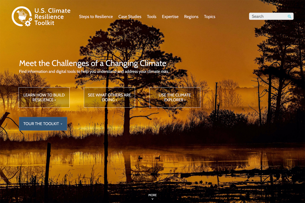
Climate Resilience Toolkit
The U.S. Climate Resilience Toolkit is a one-stop website for people and communities seeking data-driven resources to understand and address climate risks. The Toolkit is a partnership between NEMAC and the National Oceanographic and Atmospheric Administration (NOAA).
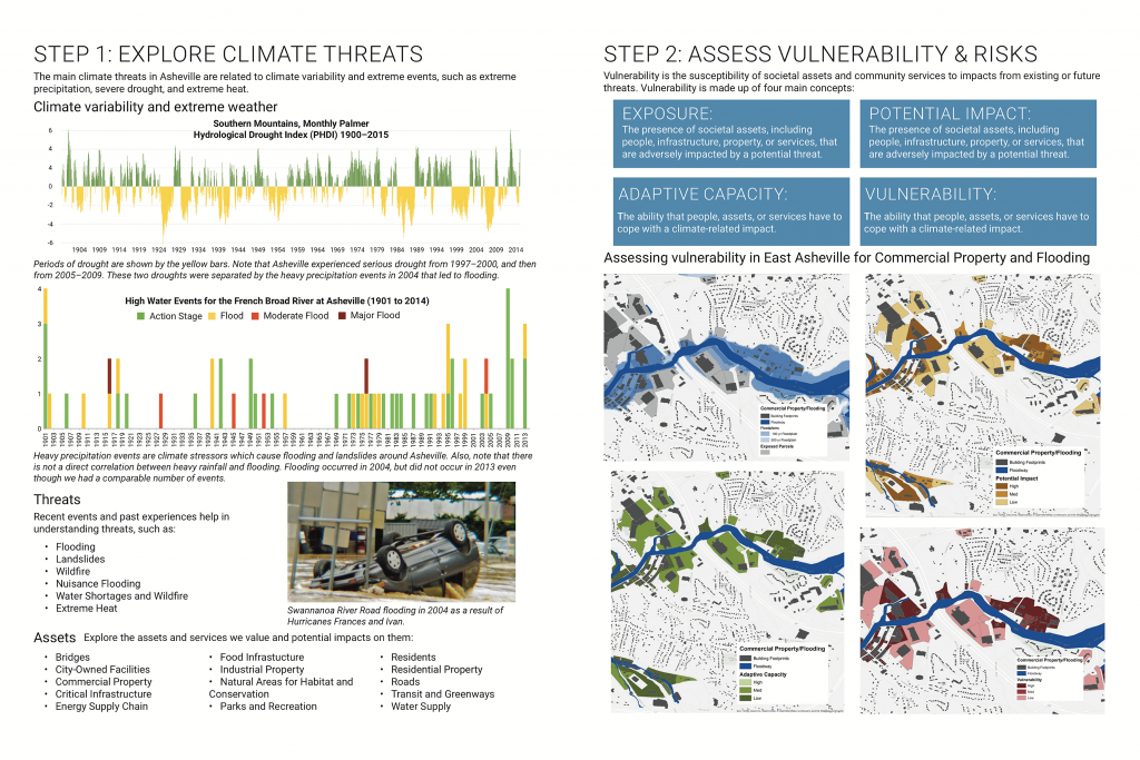
Community Resilience Assessments
NEMAC uses the NOAA Steps to Resilience framework to help cities and communities better understand their climate risks, prepare for future impacts, and build resilience for a better tomorrow.
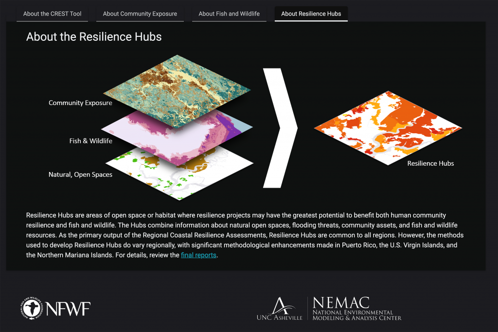
Coastal Resilience Assessments
NEMAC collaborates with the National Fish and Wildlife Foundation to identify and prioritize areas for coastal resilience and conservation projects that benefit both human and natural communities.
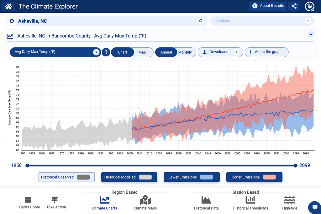
The Climate Explorer
This interactive tool, co-developed by NEMAC, allows users to explore graphs and maps of historical and projected climate variables for any county and territory in the United States.
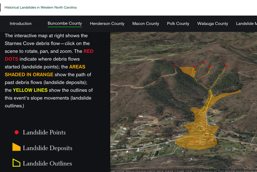
Landslide Hazard Tools
NEMAC, in partnership with the North Carolina Geological Survey, developed a landslide hazard website and viewer to communicate landslide hazards in Western North Carolina.
Forest Change Tools
Forest managers and scientists access a wealth of satellite data to monitor forest health in this suite of tools developed by NEMAC, the U.S. Forest Service, and North Carolina Forest Service.